7/29/2016
Up at 5:45 AM. I took a Benadryl and a Zyrtec last night, because the deer fly and other bites from Mehrten Creek were driving me bananas. I slept heavily, and woke up tremendously thirsty. But well-rested. I have been struggling with my defective air mattress every night, but last night I somehow managed to fill it and get the valve sealed before the air leaked out. Ahhh!

Looking back at the Hamilton Lake camping area, I hit the switchbacks to Precipice.

Katy comes up the trail behind me. She was going fast to beat the sun on the switchbacks (we both did).
I hit the trail shortly after 7:00 for the climb to Precipice Lake. I was dreading it, as everyone was talking about how brutal it was. Only 2.5 miles, but these guys were saying it was harder than the climb up to Hamilton Lake. But Katy and I cruised up there in under two hours, leap-frogging each other all the way up. Katy said that a guy told her that only the most in-shape boy scouts can manage it in two hours. Well, all right, then!

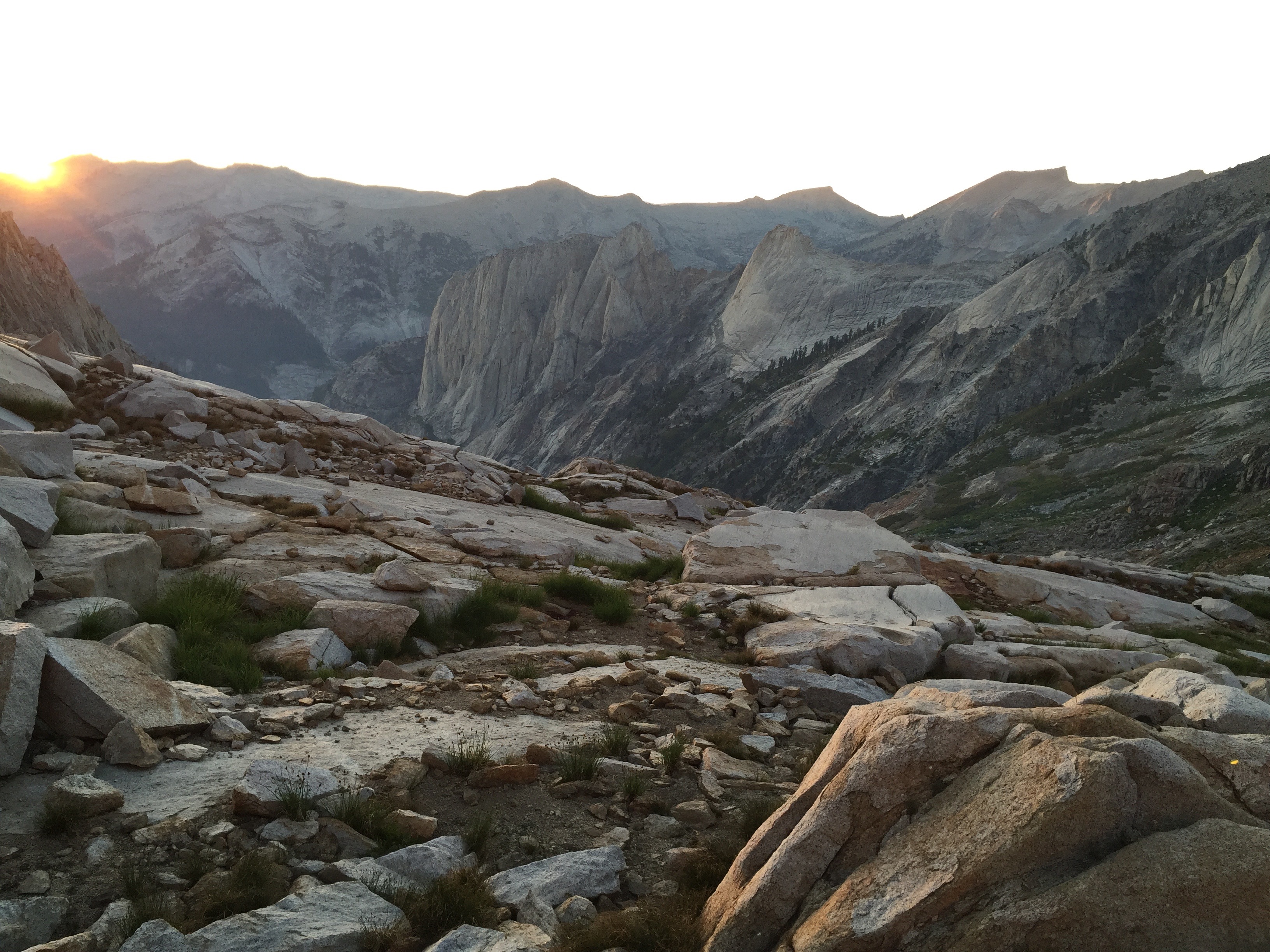
The sun crept over the peaks, where we were headed.
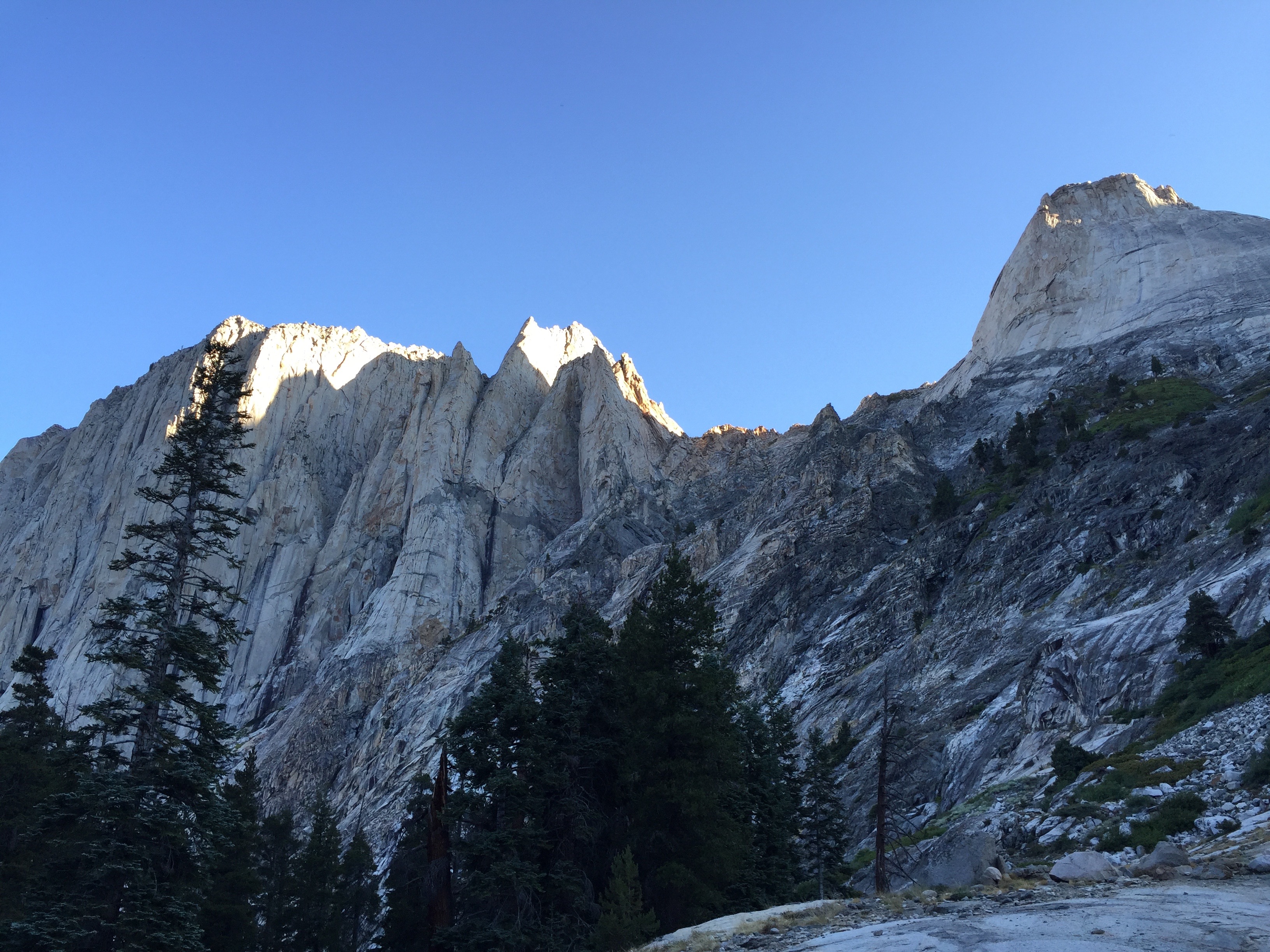
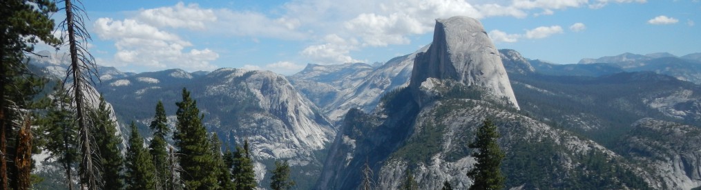
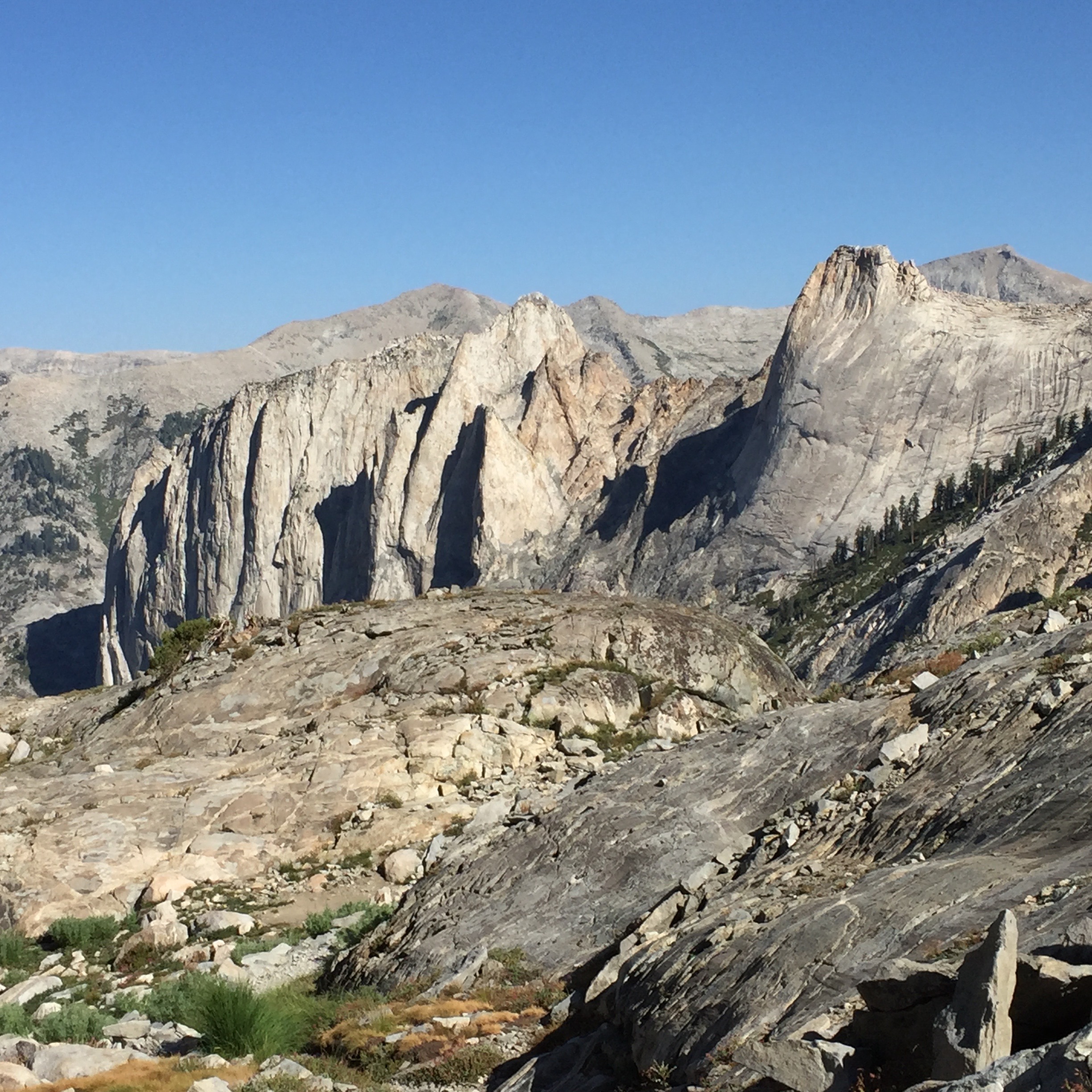
Sunlight kissed the Valhalla heights.
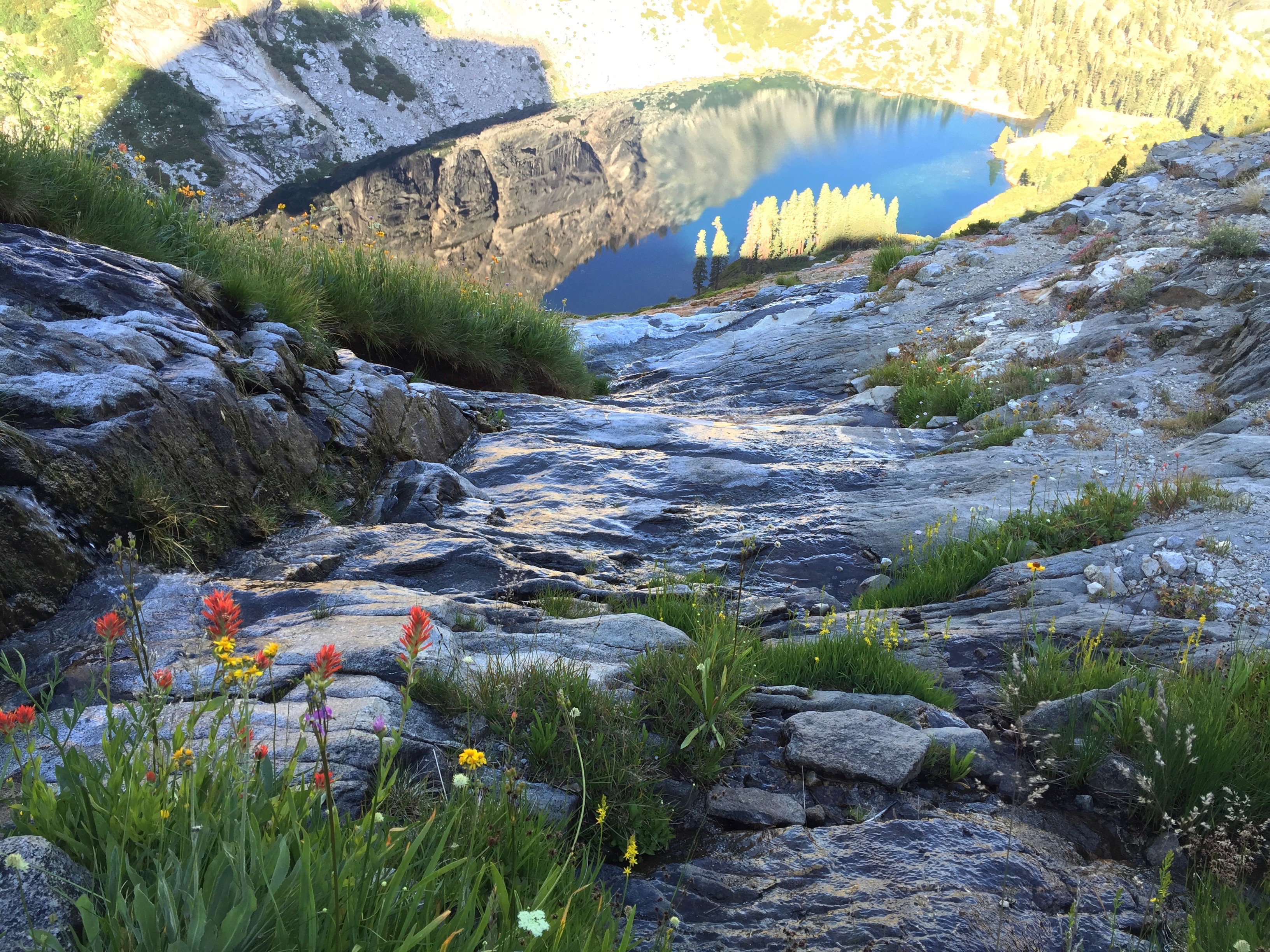
Looking down a seep to Hamilton Lake far below. Dizzying vertical drops!
There are wildflowers everywhere! Angelica, seep-spring arnica, golden aster, sierra daisy, golden yarrow, black-eyed Susans, western wallflowers, snakeweed, shooting stars, alpine columbine, ranger’s buttons, mountain pennyroyal, pussypaws, paintbrush,to name a few. Katy knew the names of quite a few. Every time the trail crossed a small waterway, the cleansing scent of pennyroyal would rise up to greet me.

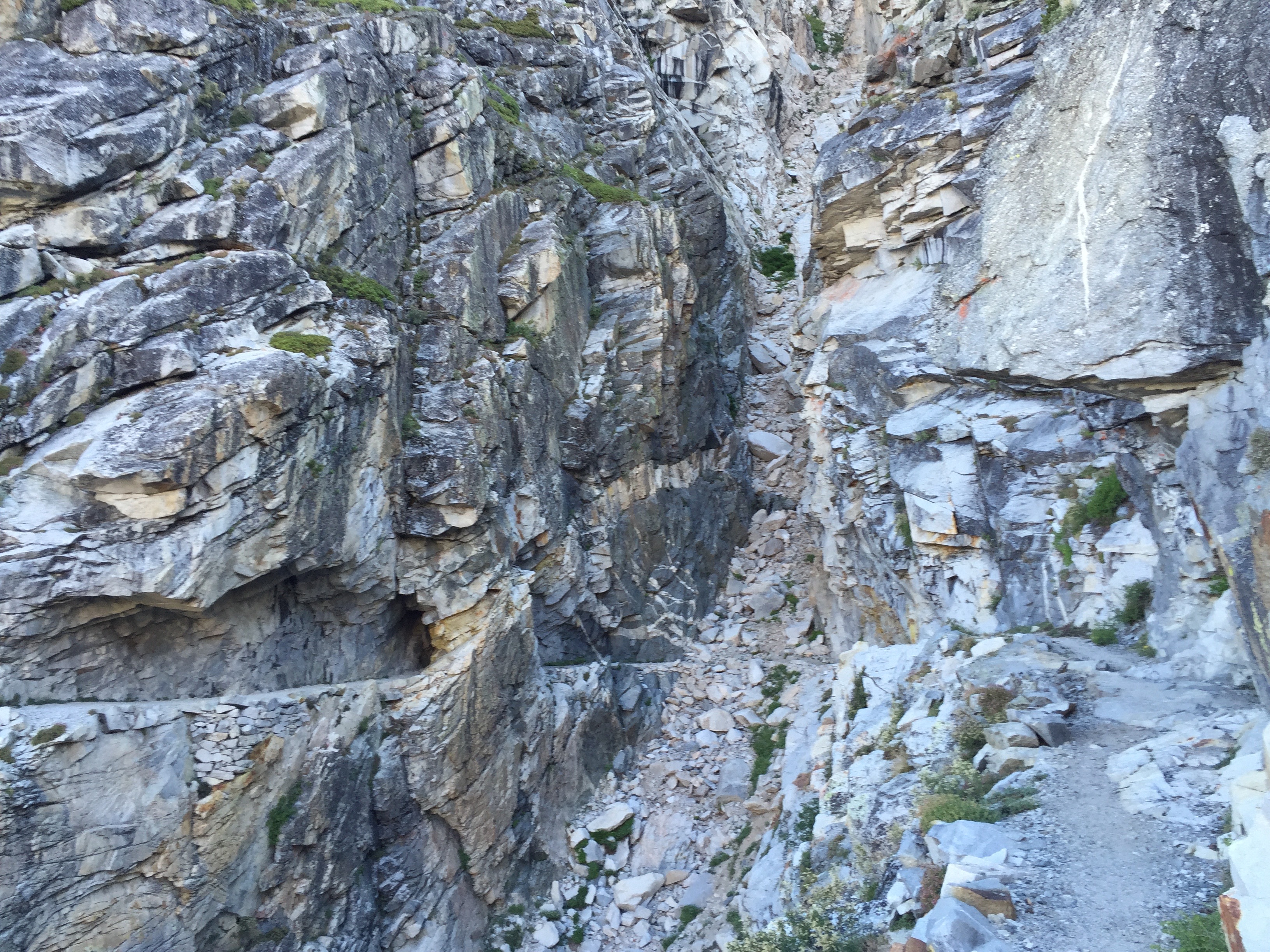
The trail is engineered to snake along tiny ledges on the steep cliffs above Hamilton. In this area, there was a canyon wren singing, magnifying his voice in the narrow canyon. And this really cool little tunnel! I am full of gratitude and admiration for the trail builders of the 1930’s who made this trek possible for us flatlanders.

This is the little lake before Precipice. There’s still a lot of climbing to do to get to Precipice. I didn’t know what to expect, and considered just camping here instead of continuing. I decided against it, and am glad I did.
From Precipice, you look out at the backs of the peaks that Barbara Higbie and I saw from Elizabeth Pass. I dropped my pack and took a swim. It was cold, but really refreshing. My skin tingled and I felt so alive.

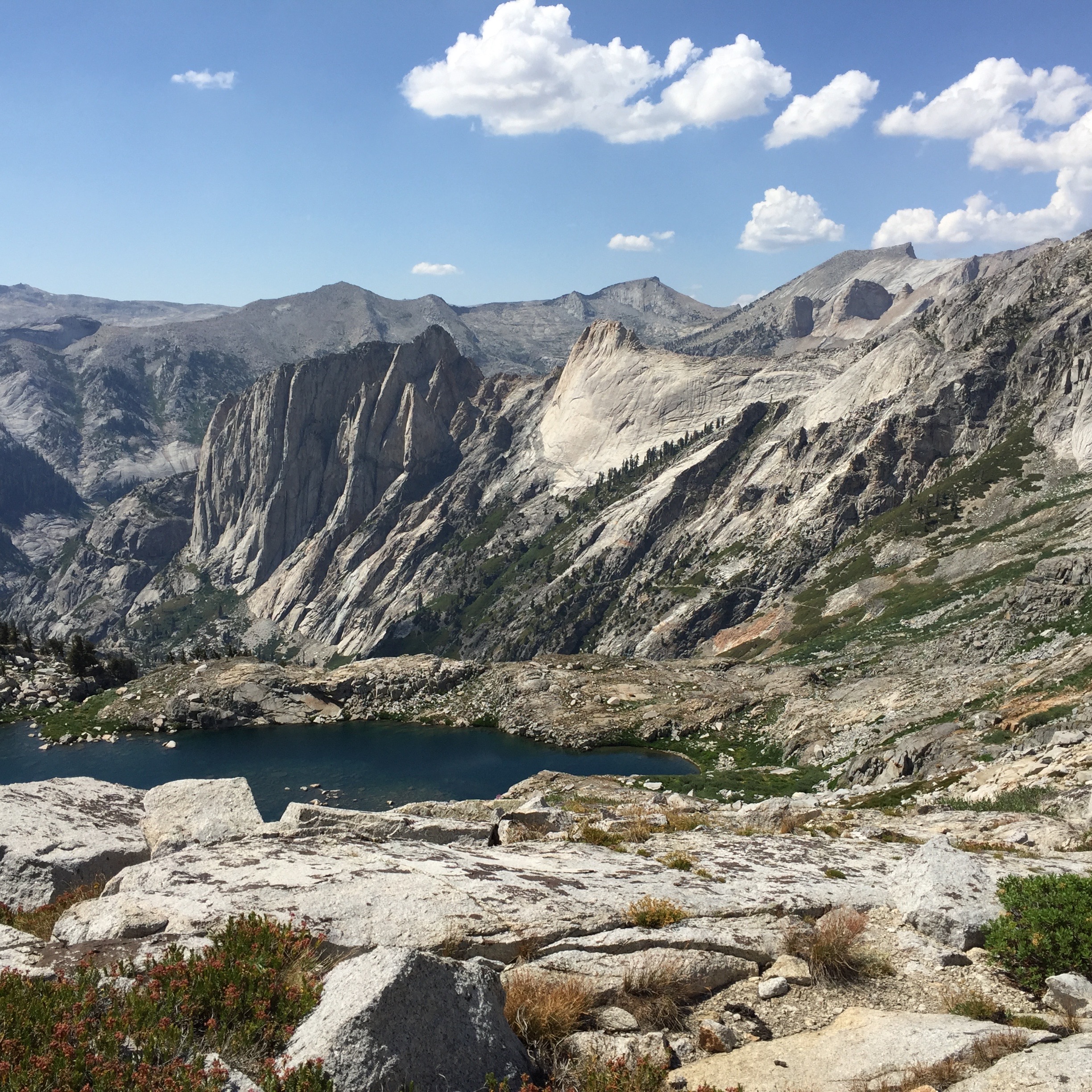
Precipice Lake at last!

The outflow from Precipice, looking out at Copper Mine Peak (on the right), near Elizabeth Pass.
Looking down on Valhalla from Precipice.
Katy was continuing on over Kaweah Gap to a campsite down the other side. I decided to walk with her up to the Gap and take a look-see. Such a perfectly beautiful trail, ascending through three little perfect terraced wildflower gardens above the treeline. The view was great, and I just wanted to keep going on down the other side. I hung out there for awhile and saw Katy off. The wind started picking up and getting colder. I hadn’t brought any other layers of clothing with me from Precipice, and just a handful of trail mix to eat. It threatened rain and spit a few drops. I’ll come back up tomorrow.

I couldn’t stop taking photos of Precipice. This is taken from the middle of the outflowing stream, looking back at the lake.

Here comes Katy, arriving at Precipice.

9 Lakes Basin, from Kaweah Gap, looks so enticing and wild! Tomorrow I will explore it.

Another view into 9 Lakes Basin from Kaweah Gap.
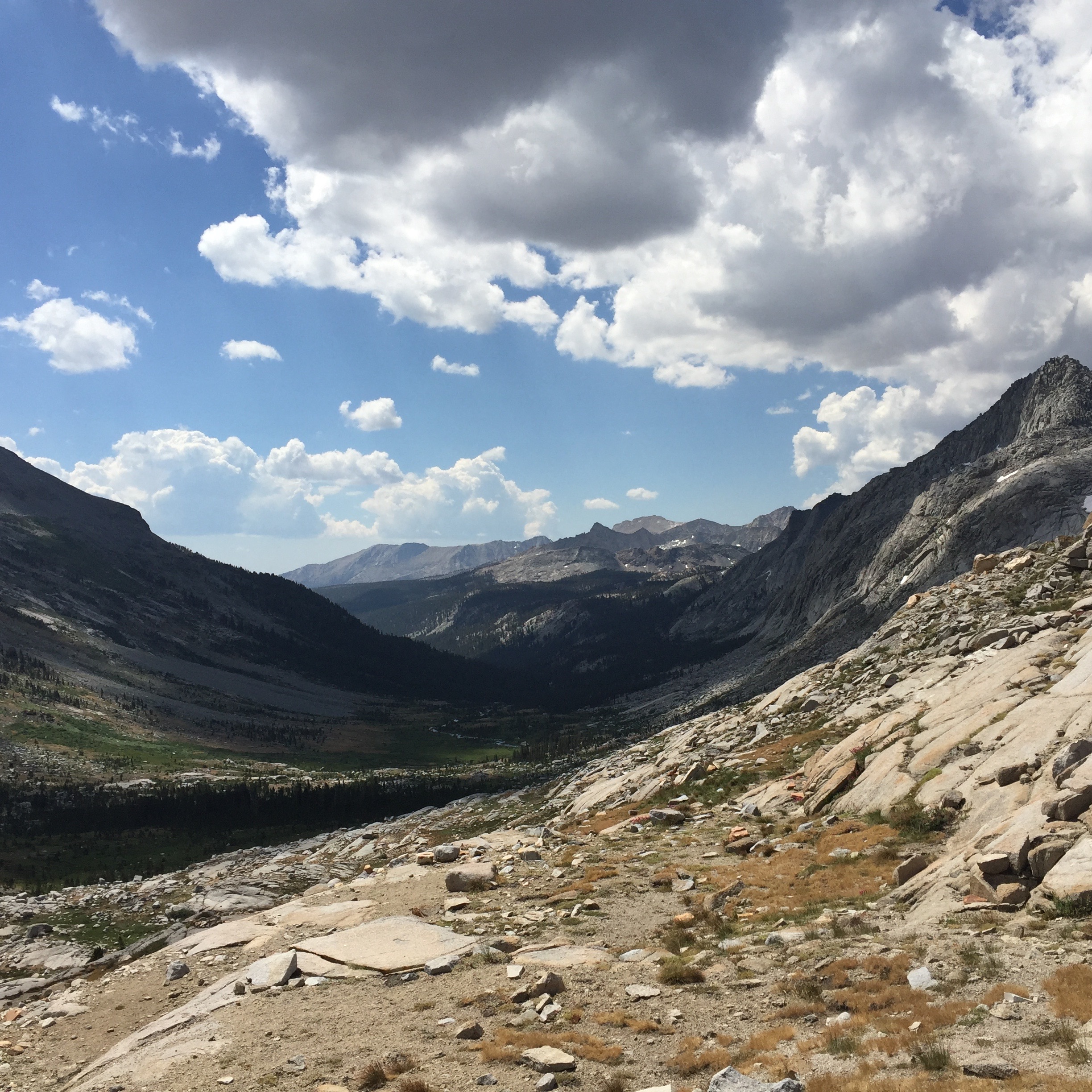
Looking down into the valley, into which the High Sierra Trail descends. All those people hiking to Mt Whitney get to walk through this lovely vale. But every step down means another two up somewhere farther along.
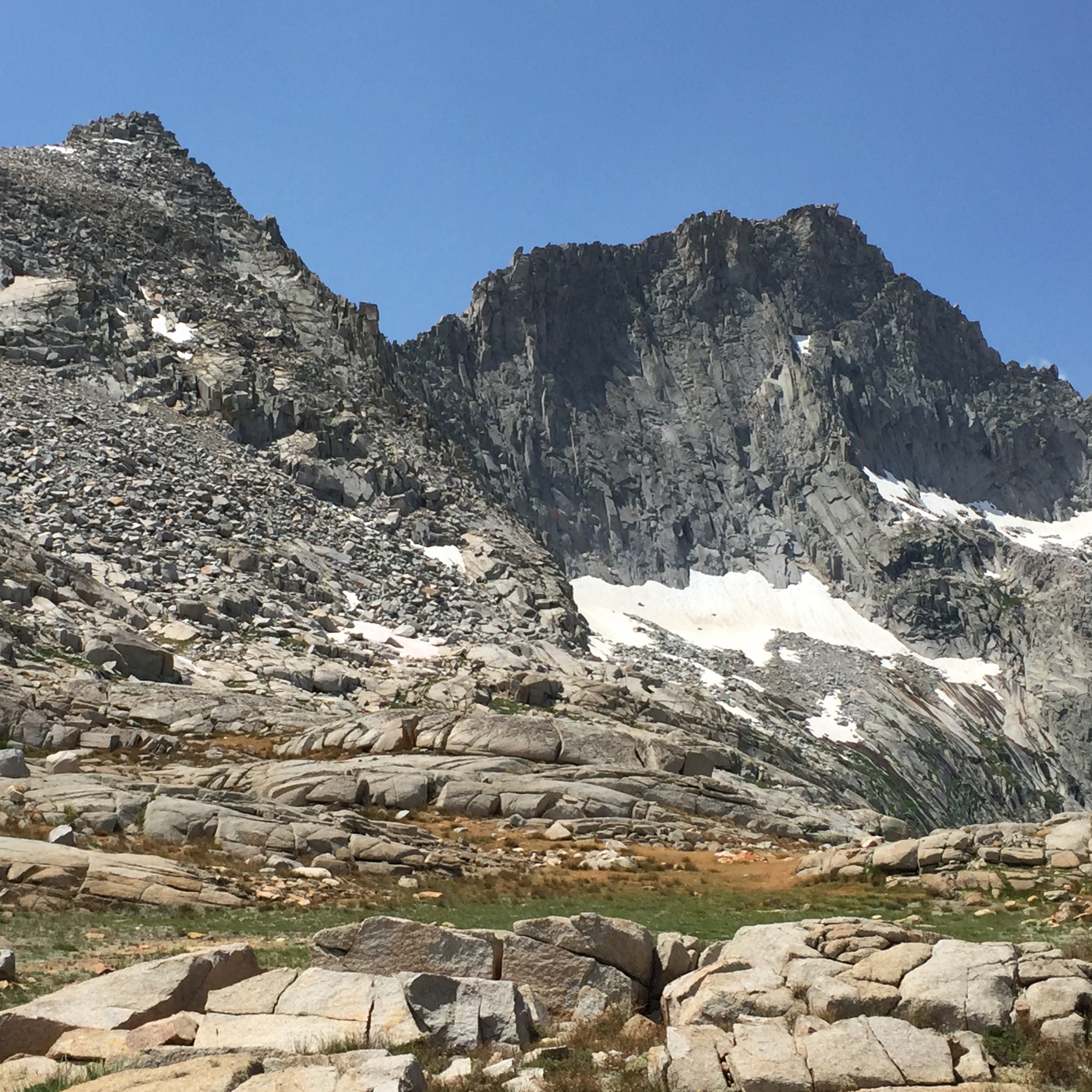
Eagle Scout Peak rises nearly vertically from Precipice Lake. I met a couple of boy scout groups who were intending to climb that peak. Apparently, there’s a trail up the backside, but when you get to the top, there are just these little boulders to stand on. It gives me vertigo to imagine being up there. This is the view of Eagle Scout Peak from Kaweah Gap.
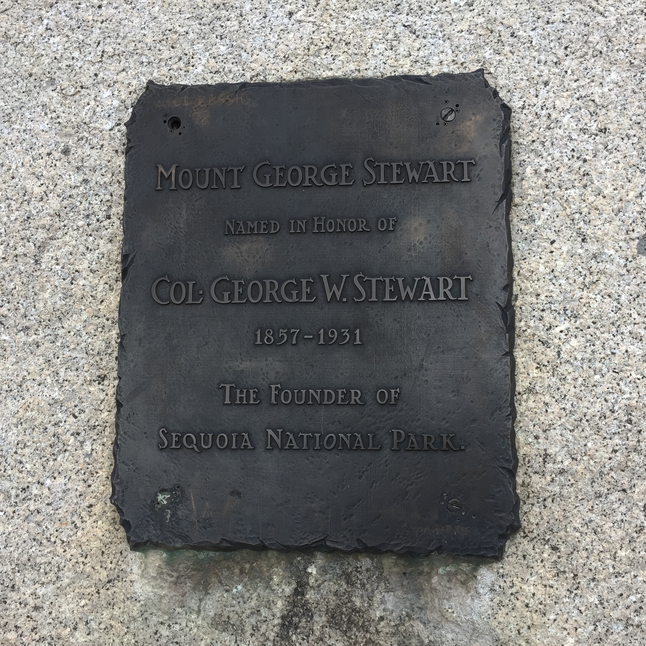

Looking up to Mt Stewart. I thank Col. George Stewart for helping to give this park to us the people.

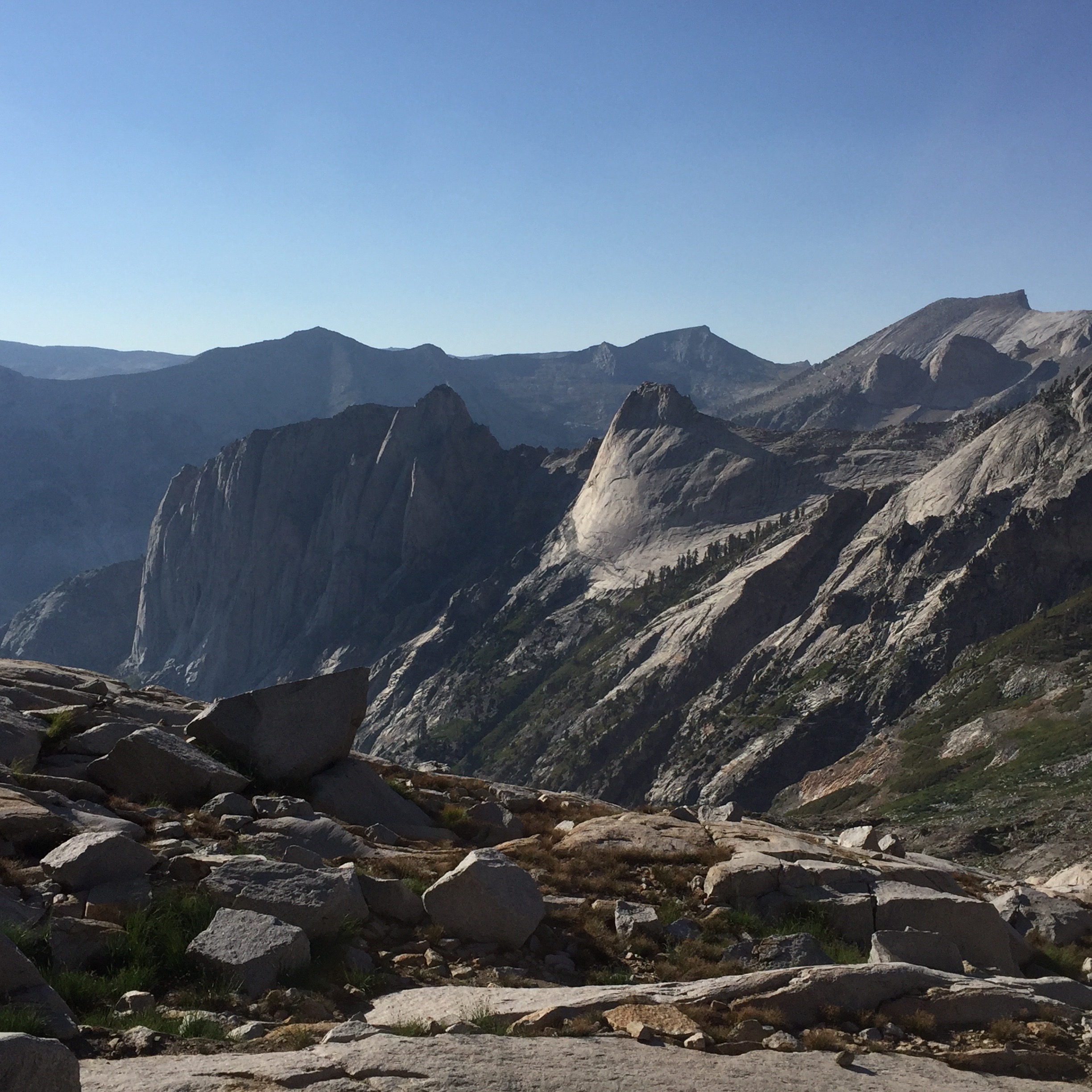
Heading back down the trail, I can finally fit all of Precipice Lake in one shot, with Eagle Scout Peak rising above.

Beautiful granite striped with water seeps from snow melt. Water is everywhere up here at this point in time, but i’m sure there’s not as much as there used to be.
Katy saw a pika on the way up the trail. I only saw a marmot. Darn. Flycatchers are flitting all over the place, buzzing to each other. When I got back to Precipice, I watched an American dipper (nee water ouzel) work its way around a portion of the lakeshore, diving under the water, swimming on the surface like a duck, and then running out onto a rock to do its little dipper dance. They are the coolest birds! I sat as still as I could while it worked its way towards me. At about 15 feet away, it must have sensed me, and abruptly flew back up the shoreline. When I heard the call, before I saw it, the name “dipper” floated into my brain. My conscious mind didn’t realize that I know their call. Its nice to know that I recognize it. Though I couldn’t describe it.

My little tent site above Precipice. Up here, one is usually sleeping on hard granite. So a sleeping pad that won’t stay inflated is a real problem. Grrrr.

The view from inside.

I couldn’t stop gazing at the Elizabeth Pass area, remembering being up there in the stormy weather a year ago. It’s quite different this year.

Yet another view toward Copper Mine Peak and Elizabeth Pass.
Yesterday, I saw a rescue helicopter bringing someone down over Kaweah Gap, maybe headed to a hospital in Fresno. Today I saw it headed out again over the Gap. Really close. I thought they were going to rescue someone else, and I would see them on the return flight, but I never did. Maybe they are stationed over on the other side somewhere. It made me think about how easy it would be to get oneself in a compromised position out here. On the way back down the trail from the Gap to Precipice, I slipped on a slick granite slab and skinned my arm. Somebody call the ‘copters! Oh, wait…there’s absolutely nobody else up here.
The wind is blowing, keeping it cool. No shade to be had almost anywhere. I fixed lunch, and then napped in my tent for a half hour. I have a view of Elizabeth Pass from my tent site. That is so exciting to me. I can start to put together a mental map of the mountains around here. A family of five hikers from Fresno came up the trail. They come to the mountains almost every weekend, and every year they do a long hike. They are hiking to Mt Whitney this year, which is what most of the people I meet on the trail are doing. They ask me where I’m headed, and I say I’m just on a walkabout. No particular destination. Just enjoying the mountains. Though I am happy to be by myself, I realize that I DO like running into these other people and spending a few minutes with them. I like having someone to share the experience with. I met another woman, hiking solo to Mt Whitney. She had started out with a friend who turned back because of a knee problem. I feel so lucky that I can just be up here and walk relatively pain-free. Everyone (the hiker family and the solo woman) are taking dips in the lake. I had to, too. It feels so great!

Oh, the water!

Photographic proof that I got in the lake.
Looking over the precipice to the lower lake.
I ate my mid-afternoon snack, and felt like I wish the sun would go down so that I could go to bed. But there are hours and hours of the day left. I am spending it trying to hide from the sun.
I didn’t write any more today, and can’t remember how I passed the hours until bedtime. Just being. Oh, yeah…and taking pictures in the ever-changing light.
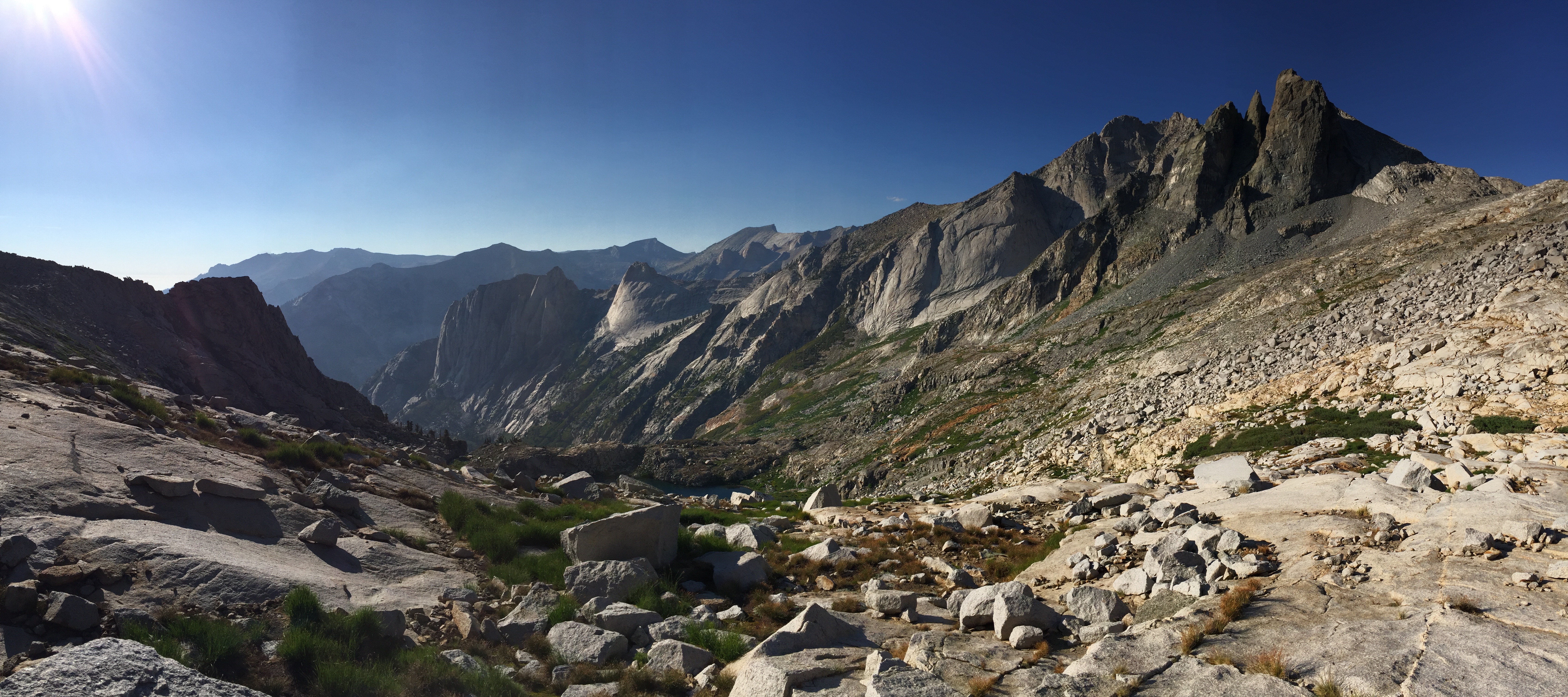
Panorama shot of my surroundings.
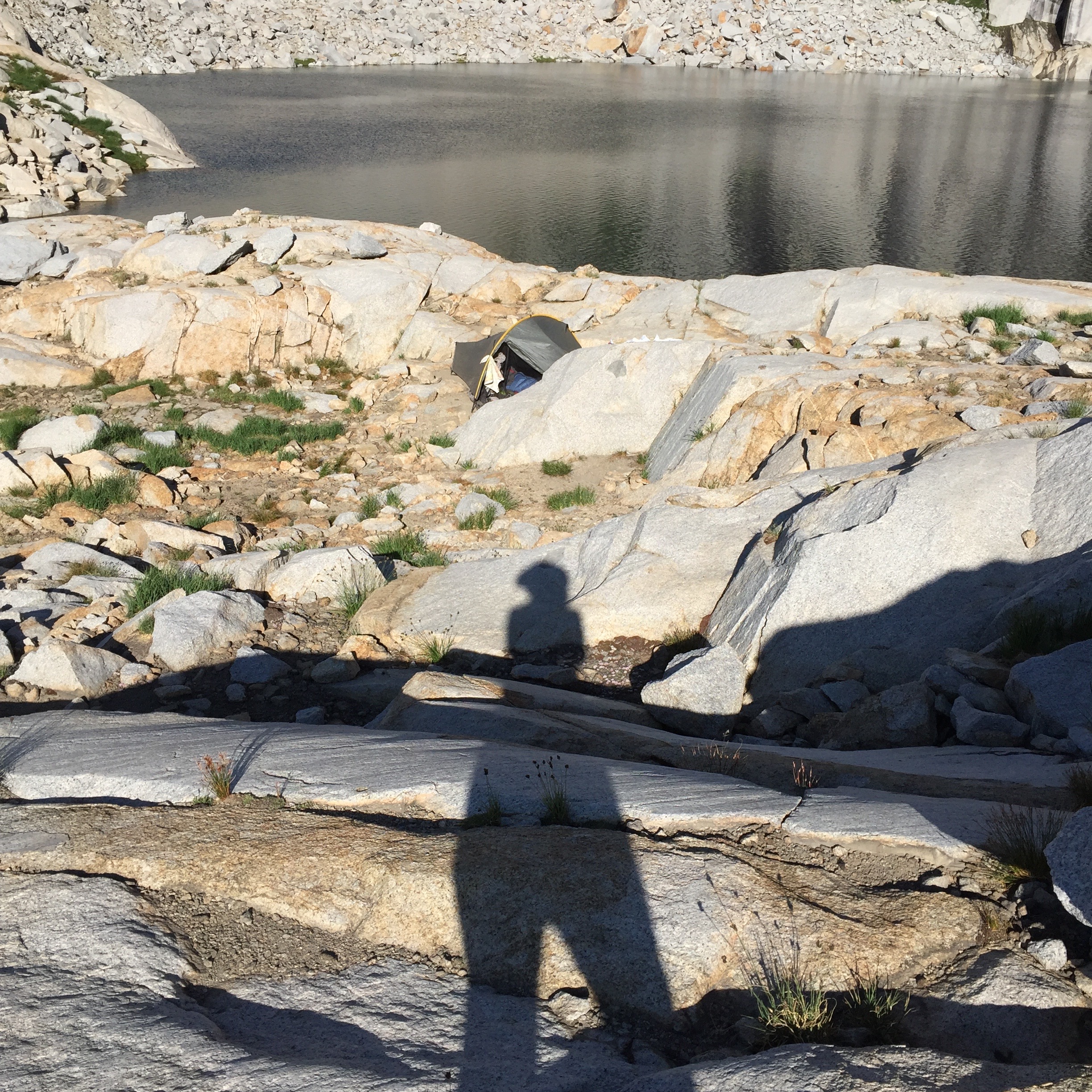
Shadow play 1.

Shadow play 2.

Shadow play 3.

The sun hits the cliffs of Precipice.

Sunset (finally).

Last of the sunlight on the peaks above Precipice.

This is so amazing. I’m so glad Jeff turned me on to your blog. I hope that when you’re out here (over here) in February, we can do some exploring in the Chisos, or Solitario, or the river or any or all of the above. There is nothing quite like those mountain lakes in the Sierras.
LikeLike
Thank you…for this neat trip…..
LikeLike
Thanks for sharing your hiking trip. What spetacular scenic photos, it sure looks like a beatiful area. I just came back from Glacier National Park. Did some hiking also. The plan is to see as many national parks as possibe.
LikeLike
GoodEar. I can hear your Birds; thanks for the Post&Pictures
LikeLike
The campsites near Precipice Lake really are great. I love how you get views of Precipice Lake on one side and views of the Hamilton Lakes valley on the other side! I did a backpacking loop from Mineral King and camped 2 nights at Precipice. Here is a report I wrote that describes the loop: https://backpackersreview.wordpress.com/trip-reports/sequoia-mineral-king/
LikeLike
Yes! This looks like a great hike. I was planning on doing the same loop this month (July), but decided that we didn’t really have quite enough time. I am considering it for a September trip. Thanks for sharing your journey!
LikeLike