July 13, 2017

The incredible snowplant!
Katie and I were on the road back to Yosemite by 6:45 AM. We finally discovered that the reason there isn’t any information online for the Tuolumne Hikers Shuttle is that the Tuolumne Meadows structures sustained so much winter damage that they aren’t running shuttles up there. So much snow! So we drove to the Porcupine Creek trailhead on Tioga Pass Road to hike to North Dome, then along the North Rim to Yosemite Falls and down to the Valley floor in time to meet the one and only bus back up to the trailhead and the car. It was scheduled to leave to Visitors’ Center at 5:00 PM.
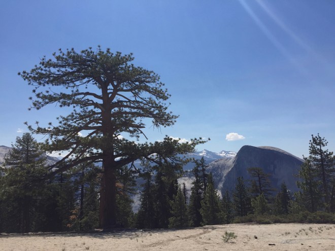
By 9:30 AM, we were on the trail. The weather was absolutely perfect! I had hiked this trail on my 50th birthday (16+ years ago), and remembered it as having truly great vistas.

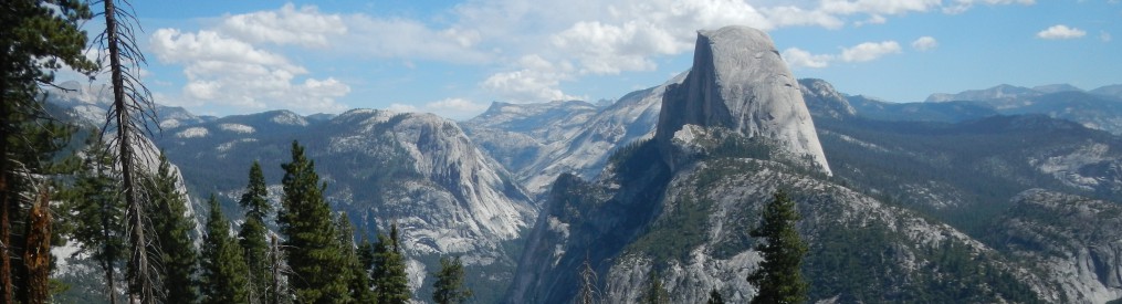
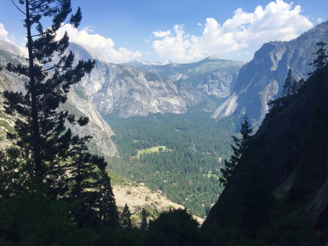
Looking across the Valley to Half Dome

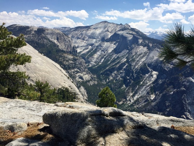
The view of Clouds Rest
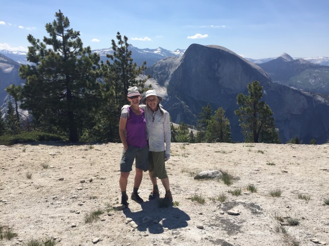
Katie and me, stopping for a rest and the view before we head down to North Dome
Unlike the previous day, the first part of today’s hike was populated by happy duos and groups bound for the first scenic overlook and North Dome. An easy hike through forests, across creeks (I took off my shoes and waded across, while Katie took a circuitous route somewhere upstream to avoid that while I waited), and up gentle slopes led us to the first views of Half Dome across the Valley, and of the vast expanse of slick glacier-scoured granite rising up to Clouds Rest.
The last bit of the trail down to North Dome is somewhat of a scramble at times, and then when you reach the saddle the trail branches in every direction leading up to the summit. It’s just wide-open stone, with very little vegetation, just a scraggly lodgepole pine hanging on here and there in a crevice. There is something about being out in all this grandeur that I think leads people to speak quietly, like being in a cathedral. Though there were lots of groups scattered across North Dome’s bald pate, it was calm and peaceful. I fought my vertigo to sit as close to the edge as I dared, among the roots and in the shade of a weather-beaten pine. We rested and just enjoyed to views for probably a little to long.

I can’t imagine a place I would rather be!

Katie consults the map, and we decide we had better get a move on.
Next time: Clouds Rest! I’ve never hiked up there before.

Look at how that cloud imitates the rocky outcropping on the skyline! Did the wind blowing across the rock sculpt that cloud?
As we bid farewell to North Dome, and headed west along the north rim of Yosemite Valley, the crowds dissipated, and we seemed to be the only people on the trail. It led for awhile through an old burned area, where the blackened trees stood stark in the brilliant mountain light.
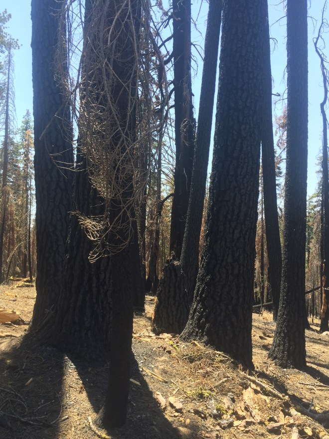
I wondered if this were the area that I had noticed being over-ripe for burning back in 2000. There was so much built-up branch and fallen-tree litter on the forest floor, that it scared me back then. I could imagine the devastation wrought by all that fuel catching fire. These trees couldn’t withstand the intensity of the resultant conflagration.

A view into the Valley, and across to Half Dome.
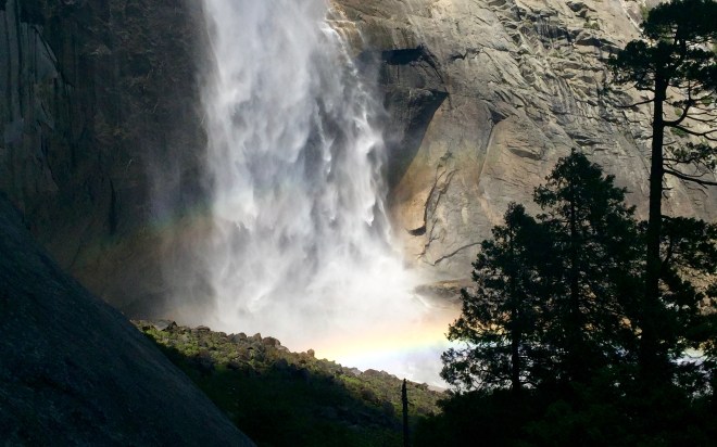
Judging by the miles left to hike, Katie and I kept up a good, steady pace along the North Rim trail, and to the top of spectacular Yosemite Falls, still running full this year from the enormous winter snowpack.
As we approached the Yosemite Falls, we started to see lots more people, who had hiked up from the Valley floor.
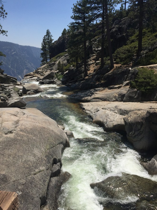
The creek looks pretty small from this view.
When you add people, you can see that it’s not that little!
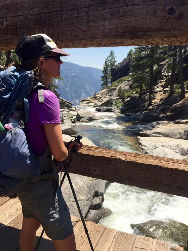
Katie on the bridge across Yosemite Creek.
As the day wore on, we realized that it was going to be a very tight connection to catch the bus back to the car. So we picked up our pace, and didn’t stop for miles and miles. We were counting on the trail being about 12 miles, but it ended up being quite a bit more than that. So we spent the last few hours rushing, tuckered out and barely stopping except to snap a few photos. The day was hot, it was dusty, and all I wanted to do was laze around and enjoy myself up there!

The first view back up to Yosemite Falls. The water thundered down to the Valley, thankfully spraying the trail on occasion with a gentle, cool mist.
The trail had been changed since I was last on it. At one point, I saw the old trail leading off to the left, and we debated whether to take it or not. It looked sort-of closed off and I worried that we would run into some obstruction that we wouldn’t be able to get around if we left the mail trail. This turned out to possibly be a mistake, as the new trail wound much further west and added miles to the trail (though it was a much easier grade).

The hours and miles seemed to crawl by, as we hurried on to catch the bus. I am a pretty fast hiker, generally passing people on the trail and swinging along quite comfortably. These last few hours, though, I was really trying to push myself. It was reminiscent of the day on the John Muir Trail that I got separated from Betty and tried to catch her (without the emotional component: see Day 5, August 17, for that story). Finally, we hit the valley floor, and realized we were still about a mile from the bus stop at 4:40PM. We ended up doubling our pace, right when I was bonking. I was ready to give up and try hitch-hiking back to the car, but Katie proved her mettle, and led me on along the paved road. No stopping for photos. No stopping to refill water bottles. No stopping to eat anything that required stopping in order to be eaten. Tired and dusty, we walked as fast as we could through the throngs of sightseers, kids on bikes, and inadvertently bombing visitors’ souvenir photos as we barrelled through.
We arrived at the bus stop about 5 minutes before the bus. I was completely fried. My iPhone showed that we had hiked 16.8 miles that day.
Finally! A place to just sit!
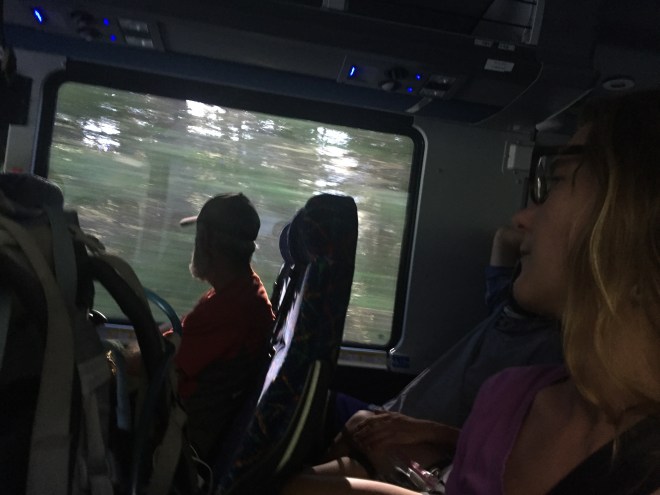
I have never felt so happy to be in a vehicle, I think. It meant that I was forced to just sit there and rest. By the time we returned to Yosemite bug Resort, we were somewhat recovered, but cured of hiking for a day. So we took it easy the next morning and lazed around until checkout, and then lazed around some more at the spa. On the way home, we went through Mariposa and stopped for breakfast at the Sugar Pine Cafe. It’s interesting going to a restaurant with a dedicated restaurant worker like Katie. She has a different and much more nuanced POV for all that is going on around us. We sat at the counter, and watched the highly efficient cooks and waitstaff doing their jobs with care and precision. And the food was great.
I can’t help but feel a little irritated at the maps for understating the mileage, and thereby throwing our timing off, so that the last few hours were more-or-less a blur for me. Still, it was an incredible, breathtakingly beautiful hike, and I would do it again in a heartbeat, and take more time. Maybe camp out somewhere on the North Rim, and just “be” for some precious hours. And next time, I am going to forsake the new trail and explore that old one along Yosemite Creek. I found it on some old maps, and it cuts off quite a bit of trail.
This ended Katie’s and my adventure for 2017. This year (2018), Katie will be hiking the John Muir Trail, and if I’m lucky, I’ll find a time that coincides with her schedule so that I can resupply her along the way.

A sudden wind whipped up Yosemite Falls, no doubt refreshing some happy hikers along the trail.
